Automating global geospatial modeling with the planetary prediction engine
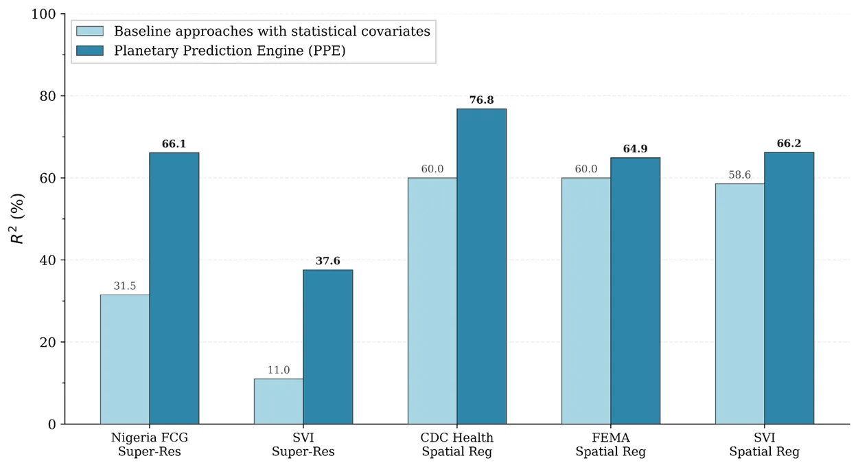
A new experimental research capability automates the entire geospatial modeling workflow from data discovery to model training. This system reduces the time required to build complex predictive models from weeks to minutes while improving accuracy across public health, food security, and environmental risk tasks.
Published by Jin · 2 min read · 28 AUG 2026
- Jul 30, 2025
- Chris Phillips
- Yossi Matias
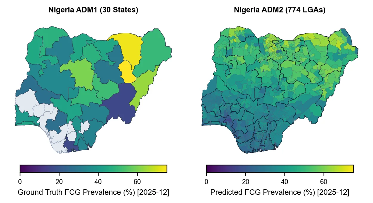
Addressing global challenges requires high-fidelity geospatial modeling, yet building these models is often hindered by fragmented data ecosystems. Specialized teams traditionally spend weeks on manual data curation, feature engineering, and spatial validation. While existing automated machine learning tools handle standard pipelines, they typically rely on pre-curated tabular data and lack the specific capabilities required for geospatial workflows.
The planetary prediction engine architecture
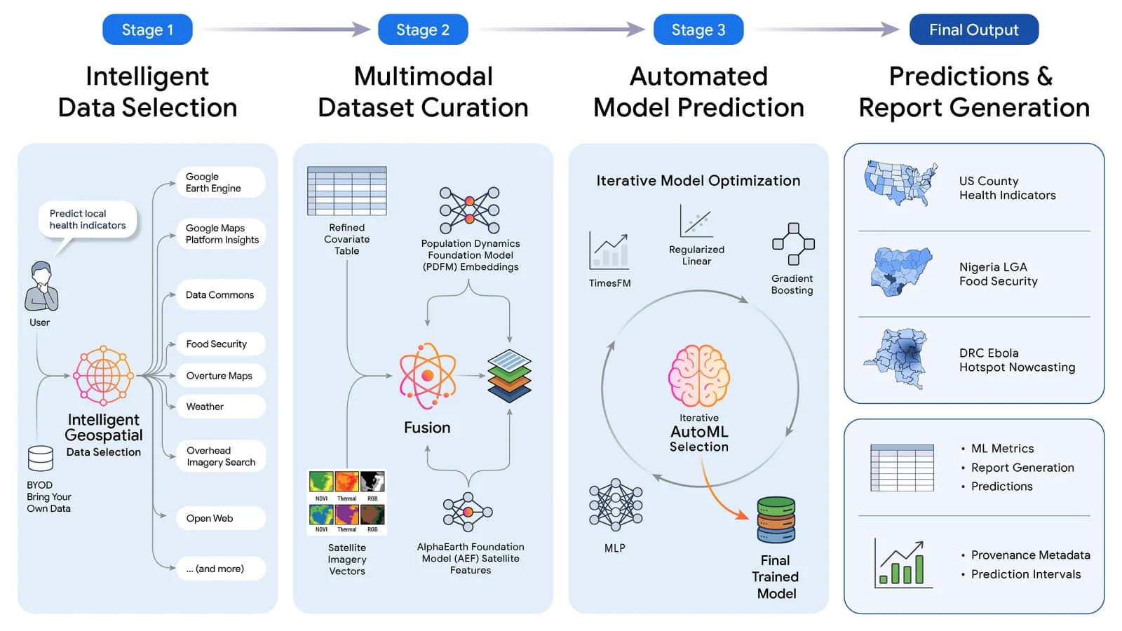
Introduced on August 27, 2026, the planetary prediction engine is an experimental research capability within the Google Earth AI initiative. Given a natural-language query, the system executes the full geospatial prediction workflow autonomously. It decomposes the process into three modular stages, each orchestrated by a language model.
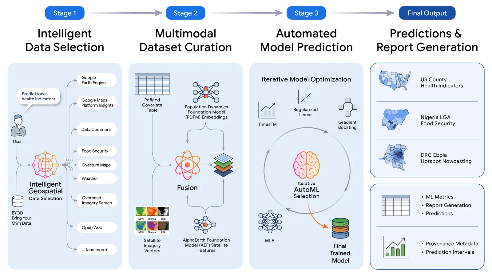
The first stage handles intelligent geospatial data selection. It translates prompts into strict geographic constraints, conducts grounded signal discovery, and retrieves covariates from repositories like Data Commons and Google Earth Engine. For missing signals, it performs live open-web discovery.
The second stage focuses on multimodal dataset curation. Assembled covariates are fused with pre-trained geospatial foundation model embeddings, including Population Dynamics Foundation Models and AlphaEarth. A strict feature gate enforces automated target leakage mitigation to ensure evaluation integrity.
Source — Original announcement ↗
Worth a read?
Comments · 0